
Tuscaloosa Previous-Resident Sources by Era
Each record set sees a different part of one address. The current parcel card identifies an assessed owner and the land. Deeds document legal transfers. A Tuscaloosa directory can name a listed occupant, while the census may show a full household in an open enumeration year. Maps test whether the site and street number align. Start with the newest reliable record and work backward without skipping links.
| Source | Years it covers | Where held | What it shows |
|---|---|---|---|
| Public GIS/CAMA parcel card | Current roll and recent notices | Tuscaloosa County web or counter | Owner, mailing and situs addresses, parcel, values, deed clues |
| Recorded deeds | Ordinary name search from March 20, 1975; earlier indexes | Probate Records and Recording | Grantor, grantee, legal description, record date, book or instrument reference |
| City directories | 1913-2003, with gaps and title changes | TPL and Alabama Archives | Listed occupants, spouse, work clues, and address |
| Federal census | Public schedules through 1950 | TPL and Alabama Archives resources | Enumerated household and relationships available in that schedule |
| Sanborn maps | Verified editions from 1884-1910 | University of Alabama and Library of Congress | Building footprint, use, construction, streets, numbers, and nearby features |
| Loose court and probate records | Loose index 1889-1916 and 1923-1950; probate varies | ADAH digital index, TPL microfilm, and Probate Court | Named parties, relationships, estates, representatives, and property links |
For a twentieth-century past-resident search, use the parcel and deeds for title, then the nearest directory and census for the household layer. Earlier work may move sooner to county books, microfilm, maps, and archives. A current tax roll cannot reveal all past residents or even every person who lives at the site now.
Start a Tuscaloosa Resident Trail
Open the Tuscaloosa County Public GIS/CAMA search with the physical street number and street name. The search also accepts owner, parcel or PPIN, account, acreage, value, tax district, and subdivision. Broad results stop at one hundred, so narrow the address before exporting. Record both the parcel situs and the owner's mailing address because they answer different questions.
Capture the parcel number, legal description, subdivision or lot and block, sale references, owner name, mailing address, assessment year, and any deed link shown. The legal description anchors the land when the postal line changes. County mapping is built from deeds, plats, wills, assessments, and surveys, yet the county warns that tax maps are not instruments of conveyance. Use the recorded deed for legal title.
- Situs address
- The physical location assigned to the parcel, distinct from the owner's mailing destination.
- Legal description
- The recorded land description, often using a subdivision lot and block or section-township-range.
- Parcel or PPIN
- A county identifier used to connect the tax roll, map, notices, and related property views.
Tuscaloosa Past Residents in Deeds
The Tuscaloosa County Probate Judge keeps deeds, mortgages, releases, plats, and other recorded instruments. The county's official online search instructions set the ordinary name-search start at March 20, 1975. An account is required, but viewing and printing are free. Earlier work uses scanned Direct and Reverse Historical Indexes, the Probate counter, Alabama Archives county microfilm, and local genealogy resources.
- Take the current owner, legal description, and deed reference from the parcel card.
- Find that owner's purchase deed and save the seller, buyer, record date, book and page or instrument number.
- Search the seller as a buyer to locate that person's earlier purchase of the same land.
- Compare the legal description at every transfer. Do not rely on a matching street number alone.
- Repeat until the online name-search cutoff, then switch to historical Direct and Reverse indexes.
- Request the deed book or a certified copy from Probate when an index entry is not enough.
- Grantor
- The party giving or selling an interest in the recorded instrument.
- Grantee
- The party receiving or buying that interest.
- Chain of title
- The linked sequence of transfers for the same land, checked backward one deed at a time.
Records and Recording is at 714 Greensboro Avenue, Room 121, Tuscaloosa. The office lists 205-464-8206, recordingrequest@tuscco.com, and copyrequest@tuscco.com. A regular deed copy is one dollar per page, and certification adds three dollars. Those fees apply to the cited county service, not to every historic source.
Note: Preserve each book, page, instrument number, and legal description before moving back, since a name match alone can join the wrong parcel chain.
Earlier Tuscaloosa Resident Indexes
A portal cutoff does not mark the start of local land records. Tuscaloosa County was created in 1818, and older deeds, wills, estates, marriages, guardianships, and limited birth or death registers may survive on county microfilm. In the Probate interface, Direct means seller or grantor; Reverse means buyer or grantee. Choose the relevant dated book and preserve its page reference.
The Alabama Archives genealogy guidance explains how county microfilm and related collections extend a search.
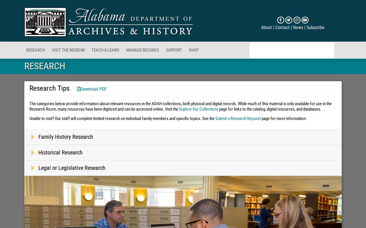
The archive guidance is the bridge from a modern deed index to older county series that retain the address and family trail.
Researchers who cannot visit can use the Alabama Archives remote research request. The service costs fifteen dollars for an Alabama resident or twenty-five dollars for an out-of-state requester, covers up to four selected sources and twenty copied pages, and estimates two to three weeks. The fee remains due if no result is found.
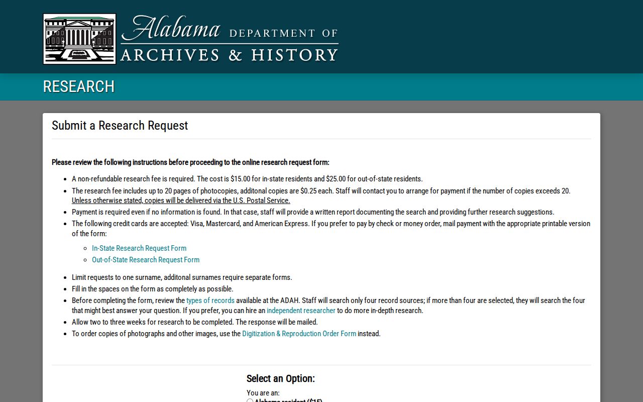
The form supports a focused request when a past-resident trail has reached a known county book, name, year range, or record type.
Map Tuscaloosa Past Resident Addresses
Six verified Sanborn editions cover Tuscaloosa: 1884, 1889, 1894, 1899, 1905, and 1910. The Library of Congress 1899 set contains 17 sheets. Across the full run, sheet counts grow from four to twenty-six. These fire-insurance maps show the building footprint, material, height or use, doors and windows, roof, street name and width, property line, house or block number, water mains, hydrants, and alarm boxes.
The University of Alabama Tuscaloosa Sanborn inventory lays out the full verified edition run.
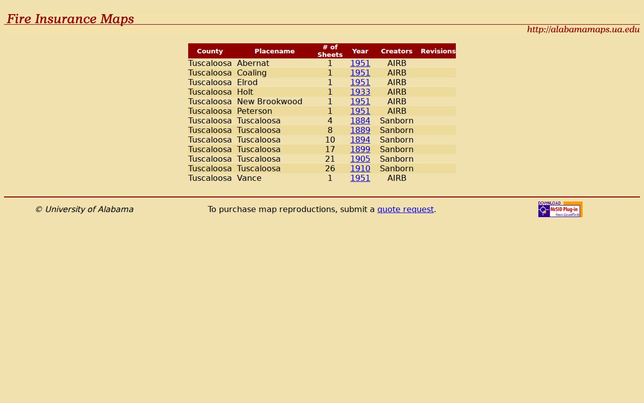
The edition table helps select the closest map year before trying to match a directory address to the built site.
A map does not name every person. It tests continuity. Match the old street wording and number, then compare nearby cross streets and the structure. The 1899 edition has seventeen public-domain sheets through the Library of Congress. When a number will not align, return to the legal description, subdivision plat, and adjacent landmarks instead of assuming the resident disappeared.
Pair Tuscaloosa Directories and Census
Deeds identify owners, but previous residents may include relatives, boarders, or other listed occupants. Tuscaloosa directories offer a separate dated layer. The verified microfilm begins in 1913 and runs through 1932; selected physical volumes extend to 2003 with gaps and changing titles. Federal census schedules are public through 1950. The two sources overlap in useful decades.
- Choose the directory issue nearest an open census year and search the address or listed surname.
- Copy the entire entry, including spouse, work clue, abbreviation, and exact address.
- Search the census by name and place, then inspect the household and nearby enumeration lines.
- Compare the next available directory issue to test a move, new listing, widow notation, or disappearance.
- Use newspapers, funeral files, cemetery records, or probate only after defining the dated gap.
The historical collections themselves are detailed on the Tuscaloosa city directory page. A telephone book can add a subscribed number or business, but it represents a narrower group than a Polk directory. The 1947-1953 digitized reel should be treated as a companion, not a complete list of local households.
Tuscaloosa Past-Resident Desk Work
Tuscaloosa Public Library ties the record trail together. Visitors sign in at the second-floor Reference Desk for archive and microfiche access and request a separate code for genealogy computers. The collection includes Tuscaloosa and Northport directories, school yearbooks, Tuscaloosa News, cemetery and funeral files, and genealogy databases. Exact item years should be confirmed with staff because the library does not publish every run online.
Reference staff can be reached at 205-345-5820 ext. 1271 or info@tuscaloosa-library.org. Ask a narrow question: one address, a small year range, known surnames, and the records already checked. That gives staff a useful starting point and avoids asking them to identify a person from a vague clue.
Tuscaloosa Past-Resident Bound Books
The 7th Floor Records Project shows why “not online by name” does not mean “gone.” Volunteers are preserving, digitizing, and indexing 602 bound courthouse books dated 1822-1961. As of February 1, 2025, 292 had been indexed. Decade indexes exist for the 1820s and 1830s. Pre-1840 volumes have direct page links, while later volumes require the book index, an image number, and the matching gallery.
The Tuscaloosa Genealogical Society project page shows the volume navigation and current project status.
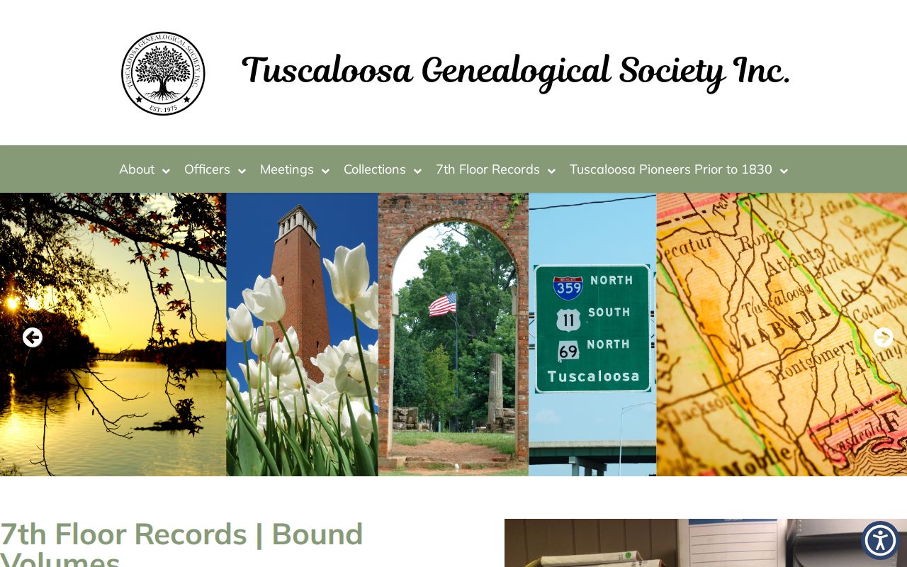
The image documents a local archive whose older indexes can extend a previous-resident search far before modern portal coverage.
This long run also corrects a tempting myth. No official evidence of a wholesale Tuscaloosa courthouse fire loss was found in the research. Do not invent a fire to explain a gap. Test the original book index, microfilm, archive catalog, and related series first.
Close Tuscaloosa Resident Trails Carefully
A directory disappearance is a question, not a conclusion. Search the next issue, test another surname form, and check whether the title expanded to Tuscaloosa and Northport in 1974 or Tuscaloosa County in 1999. Then use Tuscaloosa News, cemetery and funeral records, or a Probate Court estate. An estate can identify a decedent, representative, heirs or devisees, and property, though access to some filings may be limited.
Permits and planning cases can date work at an address and name an applicant. They do not prove who lived there. No complete anonymous permit-history database was verified, so older defined files should be requested from City Building or the City Clerk. Keep the same line between evidence and inference when comparing an owner mailing address with parcel situs.
Lawful use. Research previous residents for family history, address history, or personal curiosity. Never use records to track, threaten, harass, or harm a living person.
One clean file should end with a source log: record type, keeper, year, page or instrument number, the exact fact shown, and any conflict. That record makes the backward trail repeatable and keeps a clue from turning into an unsupported claim about who lived here before.